10 December 2010

A New View of Tethys

A prime objective of the Cassini orbital mission at Saturn is to characterize the nature and evolution of Saturn's extended family of icy satellites. Cassini observations since the beginning of the prime mission in mid-2004 have made possible the first global maps of these diverse bodies.  A team of scientists lead by Dr. Paul Schenk at the Lunar and Planetary Institute in Houston have produced the first global color and topographic maps of these satellites.  These two views of Tethys show the high-resolution color (at left) and the topography (at right) of the leading, or forward-facing, hemisphere of this 1060-km-diameter ice-rich satellite.  The color map shows the prominent dusky bluish band along the equator, first seen by Voyager in 1980, and shown by the team of scientists lead by Dr. Schenk to be due to the bombardment and alteration of the surface by high energy electrons traveling slower than the satellite's revolution period.  These findings were published in the journal Icarus (see previous posts).  The general reddish tones may be due to the coating of the Tethyean surface by dust-sized particles ejected by Enceladus' south polar plumes.  The view at right is a color-coded topographic map of the same region (blues are low, reds are high).  The total range of topography shown is 10 kilometers from highest to lowest point.  The dominant feature is the 8-kilometer-deep and 440-kilometer-wide Odysseus impact basin at upper left.  Straddling the view like a belt is a previously unknown topographic ridge between 2 and 3 kilometers high.  To the east of the ridge lies ordinary rolling cratered plains, but between the ridge and Odysseus the surface is scoured and pockmarked.  The ridge may be a tectonic feature related to the impact event or may be a deposit formed when the ejecta blasted out of Odysseus slammed back onto the surface at high velocity.  At bottom right can be seen the globe-circling trench Ithaca Chasma, formed as part of Tethys stretched apart.  This map is part of a set of new global topographic maps produced by Dr. Schenk's team for each of Saturn's icy satellites and previewed on-line on this very blog (see previous post)!


Leading Hemisphere of Tethys (base mosaic resolution is 400 meters).
Gloabl color base mosaic (left) and global color-coded topography (right).

30 November 2010

New Moons

New Moons - First Global Topographic Maps of (Saturn's) Icy Moons

At the 2010 Div. of Planetary Sciences meeting in Pasadena in October I presented some unique maps of Saturn's icy moons.  Now these are different from the ones showed in 2009 and which are now published in Icarus (Schenk et al., [2010], Icarus, doi:10.1016/j.icarus.2010.08.016, now on-line).  Those were global color maps as part of my persistent efforts to map these moons globally.  These moons are "midsize," not as big as Ganymede or Titan but large enough to be roundish in shape and have some internal geologic history.  They are Mimas, Enceladus, Tethys, Dione, Rhea and Iapetus (Figure 1a).


Figure 1a.  Global color mosaics of the 6 midsize icy satellites of Saturn.  Maps are shown to scale.  Rhea, the largest of these moons, has a diameter of ~1525 km.

So what are these new maps?  These are nearly global topographic maps of these ice-rich moons (except for the north poles), the first true global topographic maps of icy satellites we have ever had.  Until now we haven't been used to seeing icy satellites in this way because the Galileo mission was not able to return global scale mapping mosaics that would have allowed topographic maps of this type (it did return a number of higher resolution local stereo maps which have been used to make the views shown in earlier weblogs!).  Why are these maps important?  Topography directly reflects the geologic history of a world, and reveals the tectonic, volcanic or thermal processes that have modified or altered the interior.  This weblog summarizes those finding, which will be reported on in more detail in a publication Spring 2011.

These maps are derived from medium-resolution (150-2000 m/pixel) stereo images obtained by Cassini (additional high resolution stereo and shape-from-shading (photoclinometry) mapping components have been partially completed and will be added later).  They reveal a wealth of geologic information.  The maps (Figure 1) are first presented to scale, both horizontally and vertically.  Each are shown at 1 km resolution (horizontal) and have been jpeg compressed to show the topography between -5 and +5 km relative to the approximate mean elevation (this is the range which contains roughly 95% of the topography on most of these worlds. 

Figure 1a.  Global topographic mosaics of the 6 midsize icy satellites of Saturn.  Maps are shown to similar horizontal and vertical scales.  Topographic range shown is +/-5 km.  North polar areas will be filled in during the ongoing extended Cassini mission.


Global Comparisons


The presentation of satellite topography at -5 to +5 km in Figure 1b reveals some interesting features.  The most obvious feature is that Iapetus and Enceladus stand out from the others.  Enceladus is very active and has high heat flows, resulting in lo topography generally.  The exceptions are the 100-km-wide dimple-like depressions that Bill McKinnon and myself talked about back in 2009 (Schenk and McKinnon [2009], Gephys. Res. Lett., vol. 36, CiteID L16202).  Iapetus topography, on the other hand, is saturated in Figure 1b because its topographic range is ~ -12 to +12 km, roughly twice that of the other satellites (it is shown at the proper jpeg compression in Figure 2.)  The ancient age of Iapetus and its large deep basins are evident here and have been noted before by others.  But Mimas, Tethys, Dione, and Rhea all have much lower topographic ranges, indicating that if the deep topography seen on Iapetus ever formed on these worlds, it was erased or reset very early on by global thermal heating event(s), followed by the tectonic and cratering record we now see on those surface.  This means that these satellites experienced significant global heat production early on. 


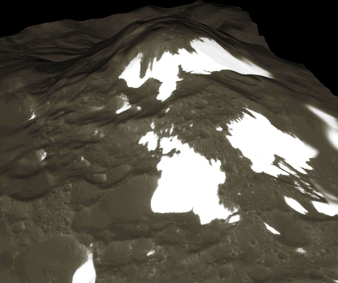
Figure 2.  Global topographic mosaic of Iapetus, icy satellite of Saturn.  Full range of topography is shown.  This map is not as complete as only 2 high-resolution encounters were planned for this satellite by Cassini orbiter.


Satellite Stories


The story is not the same for each satellite, however.  On Tethys, there are several large craters with relaxed topography (Telemus, for example in Figure 1b), but also a similar number of large deep craters (Odysseus is at least 8 km deep, Figure 3).  On Dione, however, all the large impact basins have experienced significant relaxation.  Evander is similar in relative age to Odysseus and almost the same size yet has been essentially relaxed away (Figure 4), leaving only the rim and central structures.  The implication is that Dione’s thermal heating episode lasted much longer than on Tethys.  Both satellites have smooth plains that may be volcanic reminders of these thermal episodes.  Rhea is different still.  Although there are several large basins on Rhea, they are not as frequent as on Iapetus (which is similar in size) and are half as deep.  Clearly Rhea experienced a lot more thermal heating than Iapetus.  It is not as geologically complex as Dione but also experienced a period of global expansion, forming the network of extensional graben seen in last years Rhea encounter (Figure 5).
Figure 3.  A radially averaged profile across Odysseus impact basin, Tethys.  Data from global stereo topographic map.

Figure 4.  A radially averaged profile across Evander impact basin, Dione.  Data from global stereo topographic map.  The horizontal bar shows where the crater floor is relative to the prominent central peak and outer rim structures.


Impact Impact
Internal heating is not the only signature we see on these small icy moons.  2:10 PMhe large impacts so evident in the topography (Figure 1b) also appear to have produced large-scale geologic disturbances.  In the Tethys map, a large 2 to 3 km high ridge extends in an arc due east of the Odysseus impact basin.  East of the ridge (to the right in the maps) we see fairly normal looking cratered terrains, but between the ridge and Odysseus, the texture is dominated by small irregular pits.  This ridge could be a mega-ejecta ridge formed by this enormous basin (a massive computer simulation is currently underway to test this hypothesis). 
A second large and very ancient basin can be seen in the center of the trailing hemisphere (left half) of the Dione topography map (Figure 1b).  Radial to this basin are several prominent trenches or gouges that may have been carved when this basin formed long ago.   Radial scour is also evident around Evander basin on Dione.  Numerous radial troughs are also present on Iapetus although the resolution of the topographic maps in those areas is rather poor.  Evidence for seismic shaking on the surface of Mimas may also be present in the form of flattened craters opposite to the location of the large Herschel impact there.  Evidently, large impacts can have a big impact on the geology of these icy moons. (As an aside, I will be looking closely for similar effects when we arrive at Vesta next summer.)  More details about these maps will be shown in future reports.


Figure 5.  Perspective views of Rhea’s graben network.  These are located near the center of the moon's trailing hemisphere (the left half of the maps in Fig. 1).  Produced from high-resolution stereo/photoclinometric topographic map of the region.

The Iapetus Story
As shown in Figure 2, the topographic map of Iapetus is incomplete but it does tell us that large impact basisn 8-12 km deep dominate much of the surface. The other main feature is the equatorial ridge.  The surprise here is that the ridge is definitely not continuous.  It has a maximum height of approximately 18 km (final numbers will be posted later), but in other areas is only a few kilometers high and is divided into a series of widely spaced knobs.  These knobs bear a striking resemblance to the blue patches on Rhea, which were also widely spaced along the equator.  These were attributed in our Icarus article late this year to impact on the surface of ring debris (now apparently gone) in orbit around Rhea.  The difference here is that the ring system around Iapetus proposed by Wing Ip was much more massive and accumulated much more debris onto the surface of Iapetus than on Rhea.  The key is that on Rhea we see the bluish deposits prefentially only on one side of the highest standing topography, indicating the accumulation of low-flying debris onto obstacles.  This could easily build the promontories seen on Iapetus.  Sounds like a good target for some enterprising computer particle modelers.

To cite these results, the required citations are:

Schenk, P. (2010) Global Topographic Mapping Of Saturn's Midsize Icy Satellites: System-wide Thermal And Impact Effects, Amer. Astron. Soc., D.P.S. meeting 42, abstr. 9.16.

Schenk, P. (2010) New Moons – First Global Topographic Maps of (Saturn's) Icy Moons, 
http://stereomoons.blogspot.com/2010/11/new-moons.html.

15 October 2010

Colors Published

Our major paper on the colors of Saturn's moons was published last week online at the journal Icarus.  I have indeed posted on this before (see last October and February), but as always I have a few new graphics to share.

One of the more interesting features are the broad equatorial blue bands on Mimas (discovered here first) and on Tethys (discovered by Voyager first), which are in fact due to the impact of lots of high energy MeV or greater electrons that travel more slowly in Saturn's magnetic field and appear to be spiraling in "retrograde" into the front side of these satellites.  (This is opposite of what happens on Europa due to the different energies involved).  What is so amazing is that tiny electrons have the power to alter the surfaces of these satellites.  Why the blue (really ultraviolet) brightening is unclear but the subsequent observation that these same areas are colder in the daytime than they should be (observed by my friends on the Cassini CIRS team) adds a key tot he puzzle and suggests that the surface structure is being altered on the microscopic level enough to change the thermal inertia (ability to conduct heat) of the upper centimeter of the surface!  Who would have thought.  Scientists are looking at this now with new data expected over the next few months.


Enhanced color view of the leading hemisphere of Mimas, showing the large crater Herschel and the broad ultraviolet band across the equator (shown in blue in this RGB rendering)

The second excitement is from Rhea.  First the plasma teams observed very odd signatures around Rhea in 2007 which looked rather like the telltale signs of a thin ring around this otherwise heavily cratered satellite about the size of Alaska.  Then, looking at stereo images of the craters I noticed an odd blue (really ultraviolet) patch that seemed to be right on the equator.  "What a minute," I says to myself  "Thats odd."  So I made a global map and sure enough the spots went almost all the way around!  Only a ring could do that!  But then, when the imaging camera was trained to look specifically for a Rhea ring and the next close pass for the plasma instruments happened in 2009, neither time was a ring observed.   Hmmm . . . Here we had direct evidence for surface impact onto the surface of small bits from a ring around Rhea (disturbing the dusty coating on the icy surface) and yet the ring turns out to be some sort of as yet unexplained phantom.  Well, we don't need the ring to be present today to explain the ultraviolet splotches on the surface.  They could have formed a few thousand or million years ago and still exist on the surface today.  Probably not much longer than that but thats very young for the Solar System.  Its times like these when I really enjoy my job.


Enhanced color medium resolution (2009) view of equatorial region of Rhea from Cassini orbiter.   The ring deposits are the dark splotches running east-west along center frame.  Turns out these patches don't have the same color shift as those on the leading hemisphere, perhaps due to the presence of E-ring dust on that hemisphere.

http://www.sciencedirect.com/science?_ob=ArticleURL&_udi=B6WGF-50X2NKM-1&_user=10&_coverDate=08%2F30%2F2010&_rdoc=40&_fmt=high&_orig=browse&_origin=browse&_zone=rslt_list_item&_srch=doc-info(%23toc%236821%239999%23999999999%2399999%23FLA%23display%23Articles)&_cdi=6821&_sort=d&_docanchor=&_ct=87&_acct=C000050221&_version=1&_urlVersion=0&_userid=10&md5=8c64b08a5f9d269449c99dedb4544294&searchtype=a

10 September 2010

Mountain climbing on Iapetus

A short note here to publicize the latest Iapetus video.  This one features a site 300 km to the east of the views I showed a few months ago.  In the region the ridge rises 18 km high and is more continuous in length, although there are obvious gaps.   Also there are none of the bright ice-rich patches seen in the western site.  Here the surface is completely dominated by the dark carbonaceous material that coats the leading hemisphere.
The video itself is posted on Youtube.   I have also posted an updated version of the first Iapetus video on a site called ExposureRoom.   I believe the ExpRoom posting is higher quality.  Both Links are pasted here, so please comment if you like the ExpRoom format.

http://www.youtube.com/galsat400#p/u/0/o6J69uqPVGY
http://exposureroom.com/members/DrSchenk/ab1461b0ab884401b1665b5570089518/


10 August 2010

Vestal Directions

Two weeks ago I received the news that, after a rigorous competition, I was selected to be one of a several new members of the DAWN mission to Vesta and Ceres!  Woo Hoo!  It's really a pleasure and honor to be part of this flight, the first detailed exploration of what are now termed "dwarf planets," which is just another name for the larger members of the two belts of small planetoids that orbit between Mars and Jupiter and beyond Neptune.  (I am also part of the New Horizons mission to "dwarf planet" Pluto in 2015, so maybe this is fitting.)  I will be working on cratering studies of Vesta, which is of some importance because several small asteroids and the eucrite meteorites all appear to have been knocked off of Vesta in impact collisions in the past.  We won't get to Vesta until next summer, so I won't have much to report on until then, when we start getting high-resolution images.  But there is always something exciting about seeing a world for the first time, and while the new images of the asteroid Lutetia we saw on-line last month are excellent, this will be the first time we will see the larger asteroids, worlds that may have been capable of generating molten rock and volcanic flows on the surface.  Should be exciting indeed.


NASA/ESA views of Ceres and Vesta from the Hubble Space telescope.  Not much surface detail except for the patches of bright and colored materials, some of which are likely impact craters, and the distorted shape of vesta, due to the large south polar crater that has been identified there.  

Dawn mission website:  http://dawn.jpl.nasa.gov/

07 August 2010

Saturn Triple Play - Tethys, Rhea & Iapetus

With the official release (in the UK anyway) of the "Atlas of the Solar System" by myself and Cambridge Univ. Press this past week, I thought it high time to release some new goodies.  Okay it is more views of the icy Saturnian satellites, but I do have several new Galilean satellite views ready to be posted when the book begins to appear on buyers desks.  The views shown here are clips from three new movies of Rhea, Tethys, and Iapetus.  Those of Rhea and Tethys feature distinctive impact craters.  On Rhea we see what may be the youngest large crater in the Saturn system, Inktomi, while on Tethys, we fly over one of the largest impact basins in the Saturn system, Odysseus.   Both are rather deep, but Inktomi is distinct for its extensive bright ray system radiating from the crater rim.  These rays are diagnostic of very young impact craters.  For Iapetus we fly over a broken section of the infamous and equally puzzling linear ridge that straddles the Iapetan equator.   In this region, we see several 15-20 kilometer high peaks along the trace of the ridge in a region where large portions are missing.

Link to videos:  http://www.youtube.com/galsat400


INKTOMI - RHEA'S BRIGHT RAY CRATER

This perspective view features Inktomi, a prominent 48-kilometer-wide bright ray crater on the icy surface of Rhea, Saturn's second largest satellite.  Inktomi is the youngest and most spectacular of Rhea's many large impact craters, and most likely formed within the last few million years.  The Cassini spacecraft, in orbit around Saturn, observed this crater in September 2007 at high resolution, in color, and in stereo, providing one of the best color topographic maps of Saturn's icy satellites.  These perspective views highlight the steep 6 to 7 kilometer high rim wall cliffs of Inktomi.  Rolling hills on the floor of the crater are debris mounds formed when portions of the rim collapsed onto the crater floor.  The blue color of the rim scarp (which is actually nearly white: color is exaggerated here for clarity) reveals the crustal composition of Rhea and indicates that larger ice grain sizes or a more pure ice composition may dominate below the surface.  The surface beyond the rim has been covered and scarred by icy material ejected from within Inktomi, material that also forms the extensive system of bright rays radiating away from crater center.  These perspective views are based on stereo topography derived from Cassini orbiter imaging data and are excerpted from a digital movie showing a hypothetical flight over Inktomi.  Mosaic base is at a resolution of 40 meters per pixel.  Image processing, stereo topography, and visualization were performed by Dr. Paul Schenk, Lunar and Planetary Institute, Houston.


NISHANU - ANCIENT CRATER OF RHEA

This perspective view of Nishanu, a large 120-kilometer-wide impact crater on Saturn's icy moon Rhea, illustrates the complexity of these ancient cratered surfaces.  The steep 6 kilometer deep rimwall of this impact basin is easily identified by the wide bluish ring scarp (a portion of the bluish rimwall of a smaller impact crater is also visible at lower left).  The blue color is actually nearly white and the color of the scene is exaggerated here for clarity.  It may be due to the exposure of crustal ice with larger grain sizes or less rocky impurities beneath the darker redder surface.  The bright patches at the top of the scene are icy material ejected from the nearby very young bright ray crater Inktomi.  These perspective views are based on stereo topography derived from Cassini orbiter imaging data and are excerpted from a digital movie showing a hypothetical flight over Inktomi.  Mosaic base is at a resolution of 40 meters per pixel.  Image processing, stereo topography, and visualization were performed by Dr. Paul Schenk, Lunar and Planetary Institute, Houston.


TETHYS - ODYSSEUS IMPACT BASIN

The 420 kilometer diameter Odysseus impact basin dominates Saturn's icy moon Tethys.  This view shows the eastern two-thirds of Odysseus.  Odysseus is relatively young, perhaps only 1 billion years old.  It is therefore well preserved.  The 2 to 3 kilometers high rim ridge defines the outer edge of the basin.  The total depth from rim to floor is 8 kilometers, making Odysseus one of the deepest impact features in the Solar System.  A rugged central mountain complex (at center right) forms a crude topographic ring rising 3 to 5 kilometers above the basin floor, roughly half way up to the level of the surrounding crater rim.  These perspective views are based on stereo topography derived from Cassini orbiter imaging data and are excerpted from a digital movie showing a hypothetical flight over Odysseus.  Mosaic base is at a resolution of 450 meters per pixel.  Image processing, stereo topography, and visualization were by Dr. Paul Schenk, Lunar and Planetary Institute, Houston.


EQUATORIAL MOUNTAINS OF IAPETUS

One of the many surprises of Saturn's icy moon Iapetus is the prominent topographic ridge that straddles the eauator like a walnut.  This perspective view looks east along the length of the equatorial ridge and is based on stereo topography derived from Cassini orbiter imaging data.  The Cassini orbiter acquired a strip of color and stereo images along this ridge in September 2007, near the boundary between the dark and bright hemispheres.  This stark albedo contrast has been observed since the late 1600's and was famously described in Arthur C. Clarke's novel adaptation of "2001:  A Space Odyssey."  The origin of the ridge is unknown but Cassini's stereo data indicate the ridge at this site is broken into several sharp peaks 15 to 20 kilometers above the surrounding dark cratered plains.  These are among the highest peaks in the Solar System.  Patches of bright pure water ice can be seen flanking these dark peaks, which have the brightness of soot.  The scene is ~350 kilometers across from top to bottom and is excerpted from a new movie showing a hypothetical flight over Iapetus.  Mosaic base is at a resolution of 55 meters per pixel.  Image processing, stereo topography, and visualization were completed by Dr. Paul Schenk, Lunar and Planetary Institute, Houston.


PEAKS OF IAPETUS

One of the many surprises of Saturn's icy moon Iapetus is the prominent topographic ridge that straddles the eauator like a walnut.  The Cassini orbiter acquired a strip of color and stereo images along this ridge in September 2007, near the boundary between the dark and bright hemispheres.  This stark albedo contrast has been observed since the late 1600's and was famously described in Arthur C. Clarke's novel adaptation of "2001:  A Space Odyssey."  The origin of the ridge is unknown but Cassini's stereo data indicate the ridge at this site is broken into several sharp peaks 15 to 20 kilometers above the surrounding dark cratered plains.  These are among the highest peaks in the Solar System.  This perspective view looks southeast toward one of these peaks and is based on stereo topography derived from Cassini orbiter imaging data.  Patches of bright pure water ice can be seen flanking these dark peaks, which have the brightness of soot.   The scene is ~70 kilometers across and is excerpted from a new movie showing a hypothetical flight over Iapetus.  Mosaic base is at a resolution of 55 meters per pixel.  Image processing, stereo topography, and visualization were performed by Dr. Paul Schenk, Lunar and Planetary Institute, Houston.


EQUATORIAL TOPOGRAPHY OF IAPETUS

The Cassini orbiter acquired a strip of color and stereo images along the equator of Saturn's icy moon Iapetus in September 2007, near the boundary between the dark and bright hemispheres.   This view shows an area of the equator on the trailing hemisphere crossed by low ridges and fault scarps.  The prominent equatorial ridge seen elsewhere is mostly missing in this scene and replaced by low ridges and fault scarps trending north-south.  This perspective view looks south across the equator and is based on stereo topography derived from Cassini orbiter imaging data.  Patches of bright pure water ice can be seen flanking some of the darker cratered slopes.  The scene is ~100 kilometers across and is excerpted from a new movie showing a hypothetical flight over Iapetus.  Mosaic base is at a resolution of 55 meters per pixel.  Image processing, stereo topography, and visualization were performed by Dr. Paul Schenk, Lunar and Planetary Institute, Houston.

06 April 2010

Return to Dione

This week Cassini makes its second very close flyby of complicated Dione.  It will search for signs of activity on this enigmatic icy satellite of Saturn.  Although only 1100 km across, it is perhaps second to Enceladus in terms of complexity.  Despite that, no obvious current activity has been detected.  Way back in the 1980's, shortly after the Voyager flybys first mapped these moons, several investigators including Jeff Moore argued that the smooth plains on Dione's leading face were formed by some type of effusive volcanism involving water and water ice.  At a Lunar and Planetary Science conference a few years ago, Jeff Moore and I further proposed that a set of oddly-shaped craters seen by Cassini near Dione's equator during its ongoing mapping efforts were in fact volcanic calderas, formed by more energetic styles of volcanism, including explosive and collapse volcanism.  These pits are 30 to 40 km across and very shallow.

The views shown here include perspective views of these putative volcanic features, as well as relaxed craters, smooth plains and narrow sinuous canyons that could be volcanic flow channels.  Hopefully Cassini will help answer some of these questions.


Dione: North Polar Region.  The large relaxed impact crater is 150 km across.  The narrow canyons originate near the north pole and could be lava channels.


Dione:  Equatorial Smooth Plains.  The irregular pits in the background are 30 to 40 km across and could be volcanic calderas.  


Dione:  Smooth Plains.  The largest crater is 105 km across.  Its large central peak towers 3 km above the plains and is a classic indicator of viscous relaxation and a sign that Dione's internal heat flow was once much higher than today.


THE VIDEO:

02 March 2010

Mimas Rejoinder: Those Pesky Icy Satellites Between the Rings and Titan

In addition to the Rhea views I released last week (see preceding posts for Blue Streak on Rhea!) to mark the Rhea encounter scheduled for later today, here are some of the other neighboring satellites.  Included is a perspective view of Herschel, the large 140-km-wide 11-12 km deep impact basin on Mimas that lends it the infamous Death Star appearance.  It is based on lower resolution data from 2005-2007 (I would use the newest images but I am expressly forbidden to use Cassini data until it is 1 year old).  Other views include some nbew ones of fractures on Tethys and Dione (Enceladus is extensively covered in older posts).  Enjoy!

Herschel impact crater on Mimas (left). Herschel is 140 kilometers across and 11-12 kilometers deep, one of the deepest in the Solar System!
The rugged cratered highlands of Mimas (right).  One of this small icy moon's linear grooves, formed when the moon fractured, crosses in the foreground. The largest craters here are about 35 kilometers across.

Cratered highlands and fractures of Tethys (left). The linear fracture valley is part of the giant Ithaca Chasma fracture system. The largest crater here is 45 kilometers across.

Cratered highlands and scarps of Tethys (right). The band of linear scarps is part of the global Ithaca Chasma fracture network and here is about 125 kilometers across.

 Craters and fractures of Dione.  The largest crater is 100 kilometers across.  (Here color is topography, blues are low, reds are high)

25 February 2010

Rhea's Blue Streaks - Rings and Other Things!


This perspective view shows one of a series of relatively blue patches that form a very narrow band only 10 kilometers wide that straddles Rhea's equator.  The bluish material is fresh ice reexposed when material from Rhea's ring struck the surface along the equator, and will be a target of investigation during the March 2 Cassini flyby of Rhea.  The smaller craters with the bluish deposits in the center of the frame are typically 3 to 10 kilometers wide and less than one kilometer deep.  This view is looking toward the west along the equator.  This view was created using stereo topography generated by Dr. Paul Schenk of the Lunar and Planetary Institute in Houston Texas from Cassini imaging data returned in 2008.  The colors have been enhanced to highlight the color differences between these patches and the cratered terrains of Rhea.

It's a busy time for satellites on Cassini.  An extremely close pass of Rhea a scant 100 km above the surface March 2, a brush with tiny Helene the day after, and a 500 km pass of Dione in April are all coming up very quickly, close on the heels of our only close pass of Mimas, the subject of my most recent post.  As posted here in October, I've been working extensively on color mapping of these moons and their neighbors and this work has now been submitted for publication at the journal Icarus.  These color maps reveal a host of interesting phenomena and a few surprises, and the new data will help us understand these features better.

But first heavily cratered Rhea.  Going into orbit 6 years ago, Rhea was regarded as the ugly stepchild, the "Callisto," of the Saturn system.  Little was remarkable about this second largest of Saturn's icy satellites, but it should be axiomatic by now that the closer you look at a planetary object the more surprises you see.  The biggest surprises so far are the belt of graben fractures running north-south on the trailing hemisphere and the purported circum-Rhea debris ring reported in 2007.  The fractures betray a degree of thermal activity on Rhea. Perhaps they are stretch marks formed when the satellite cooled and the icy lithosphere contracted, stretching the surface (though why they would form only on one side is not clear). 

The debris ring around Rhea is even more puzzling.  In fact the discovery has been greeted with some scepticism in the ring community (ring particles are too small to map geologically so I haven't paid too much attention, until now).  Unlike the main rings or Enceladus' plumes, the Cassini cameras see no glow from Rhea when it is backlit, indicating that the debris ring is not very dusty.  So it came as a pleasant surprise when our group discovered the very narrow bluish streaks along Rhea's equator (this feature was also discovered independently by two other groups).  We have completed the first mapping of these features and report on it in our new journal article (see my blog of October for detailed images).  Although the streaks are not continuous, they can be traced over at least 270 degrees of Rhea's circumference and lie within ~2 degrees of the equator.  Most likely, discrete portions of Rhea's surface have been impacted onto its surface.  A further curiosity is that the blue streaks formed only on high-standing rises or ridges.  In one area, for example, they formed only on the high-standing rim of a large crater straddling the equator.  This indicates that the particles were in low orbit and preferred to strike the highest standing topography first.  This leads us to the videos I am releasing today.  They feature the heavily cratered terrains of Rhea.  The second of these videos ends with a pass over one of these bluish features, which lies across a broad cratered ridge crossing the equator of Rhea.  The nature of these patches suggests they were small and disrupted the surface, reexposing blue material.

In our paper we also discuss the equatorial blue bands of Mimas and Tethys (see my preceding post this February and the post in October).  Without going into too many details, we find that the patterns on both moons are almost exactly matched by the impact pattern of a particular type of retrograde trapped electrons hitting the front side of these two satellites.  Yes, some particles do drift backwards within Saturn's magnetic field.  We also find that the color pattern on Enceladus differs from all the others.  In this case, the pattern matches the predicted fallout and deposition particles from Enceladus' icy plume back onto the surface.  It also seems that the plume material blocks other particles from hitting Enceladus and thats why we do not see the equatorial bands on this satellites.  Two more mysteries solved!  The annual Lunar and Planetary Science Conference is coming up next week so I will be busy but stay tuned to this iChannel for more news on these bodies in the next two weeks.  


These perspective views of Saturn's second largest moon, Rhea, shows the western half of its second largest impact basin, Tirawa.  This ancient impact basin is 370 kilometers across and roughly 6 kilometers deep.  The broad arcuate scarp cutting across scene center is the battered rim of Tirawa.  The floor of Tirawa, at right in top view, left in bottom view, is heavily cratered, indicating it formed in ancient times when a 30-40 kilometer wide comet struck Rhea.  The two large craters just beyond the rim are 55 and 60 kilometers across.  This view was created using stereo topography generated by Dr. Paul Schenk of the Lunar and Planetary Institute in Houston Texas from Cassini imaging data returned in 2008.  Although enhanced, the color in this view is an approximation of what we might actually see.

This view of Rhea's blue streaks is looking toward the north across the equator shows one of a series of relatively blue patches that form a very narrow band only 10 kilometers wide that straddles Rhea's equator.  The bluish material is fresh ice reexposed when material from Rhea's ring struck the surface along the equator.  This view was created using stereo topography generated by Dr. Paul Schenk of the Lunar and Planetary Institute from Cassini imaging data returned in 2008.  The colors have been enhanced to highlight the color differences between these patches and the cratered terrains of Rhea.

The videos:


10 February 2010

Mimas Rising

In less than a weeks time (February 13 in fact), the Cassini spacecraft makes its first very (and only) close pass of Mimas, the innermost of Saturn’s major icy satellites. Like Galileo at Io, Jupiter’s volcanic moon, this inner moon was deferred to late in the missions but for slightly different reasons. Io is deep in Jupiter’s lethal radiation belts and the Io encounters were postponed to minimize damage to the vehicle, and getting down to Io’s orbit also required a lot of orbit reduction. But the mountains and volcanoes of Io did not disappoint and fantastic discoveries were the result.

View of Mimas similar to that expected from Cassini, February 2010. The prominent large crater is at left is Herschel, the largest on this small icy moon
Topographic profile across crater Herschel, one of the deepest in the Solar System

Who Cares for Mimas?
Mimas is close to the outer edge of Saturn’s huge ring system and Cassini has not ventured very close, until now. The radiation danger is much lower at Saturn, but Mimas is not Io. Despite being only just a little smaller than crazy Enceladus, with its massive erupting ice plume, Mimas is in fact rather duller. Voyager made Mimas famous when it took the infamous Death Star image showing the large crater Herschel looking much like that battlestar’s large laser dimple. It would be a mistake to disregard Mimas as a cold cratered lump of ice, however. All of Saturn’s other icy moons have betrayed some level of geologic activity in their past. The largest crater Herschel, about 130-140 kilometers across and 11-12 kilometers deep, is one of the deepest in the Solar System. It may also be relatively young, providing an opportunity to study how craters on these icy worlds form and what they might tell us about the interior. Voyager mappers, myself included, saw sets of linear grooves that are most likely extension fractures crosing the globe. Whether these fractures formed when Mimas cooled and expanded or when Herschel knocked Mimas for a loop remains to be determined.  Herschel was potentially large enough to have fractured Mimas throughout.
A map of Mimas grooves I made in 1989 based on Voyager images

Mimas Looms Large
Diminutive Mimas, named after a giant (!) of greek mythology, is only 400 kilometers across. It is also distinctly non-spherical as its polar axis is 10% shorter than the longer equatorial axes. The degree of sphericity could be used to tell whether Mimas has a small rocky core or not (it is otherwise mostly made of ices).  Plus there is something very new (to us at least).   I reported on this in one of my October blogs on this site. It is a lens-shaped deposit of “bluish” “stuff” along the equator of Mimas’ leading (forward-facing) hemisphere. This material appears to coat the cratered surface. We now have an explanation for this feature, and a similar one on Tethys. Unfortunately I can’t tell you the exact answer right now, as this paper has been submitted for review and we should wait until it is approved.  I will post all the details on this phenomenon in a few weeks!
The best current map of Mimas from Cassini. Map resolution is ~400 m and in color

Mimas Soon
What can we expect at Mimas? The Cassini flyby on the 13th occurs near orbit perigee (peri-kronos?) and will be very fast indeed. Although it will pass only 9500 kilometers above the surface, it will have less than an hour or so near closest approach to get the highest resolution images at something like 50-75 meters resolution (our best so far are only 350 meters or so). This should be good enough to get an image or two in which Herschel fills the camera frame. This encounter should thus provide an excellent view of Herschel and fracture systems to the east of the crater. The whole of Mimas will almost fill the wide-angle camera at this time, as well. As Cassini recedes it will likely do global disc mapping of the Herschel side of Mimas, including some of the fractures to the west. It should be an exciting weekend, this being the first good look at a body we haven't yet seen at high resolution.

http://www.youtube.com/watch?v=CwWBZFIBkr0

Rotating Mimas, based on my current global map (shown above)

06 January 2010

Padova and Galileo - 1610-2010 Celebration (New Videos)

Buongiorno!
If you have noticed that I havent posted anything here in the past two months, it is mainly because I have been preparing a big set of new videos of the Galilean satellites to support the 400th anniversary celebration here in Padova, where the actual event occurred on a cold winter night not unlike the cold weather we are having now. I sit in the cozy comfort of our hotel room this morning overlooking the cold (1°C today) train station uploading video to facebook. It will probably take the rest of the day to complete. I will have more to report tonight after the official reception for the meeting being hosted here. I am supposed to lead a tour of some large posters I contributed to the celebration. In the meantime, I post some stills below as videos continue to upload.
ciao!
paolo

Youtube channel:  www.youtube.com/galsat400

(watch for updates to this post over the next day or so!)